Lunatide
Lunatide app icon: a full moon over layered ocean waves Tides · Surf · Boating · Moon · Fishing

The ocean, the moon and the swell. All in one glance.

Lunatide shows the tide where you are over a living satellite view of your coastline, with real weather drifting across it and waves that rise and fall with the actual tide.

Coming soon to theApp Store See what it does
7-day surf forecast for Santa Barbara
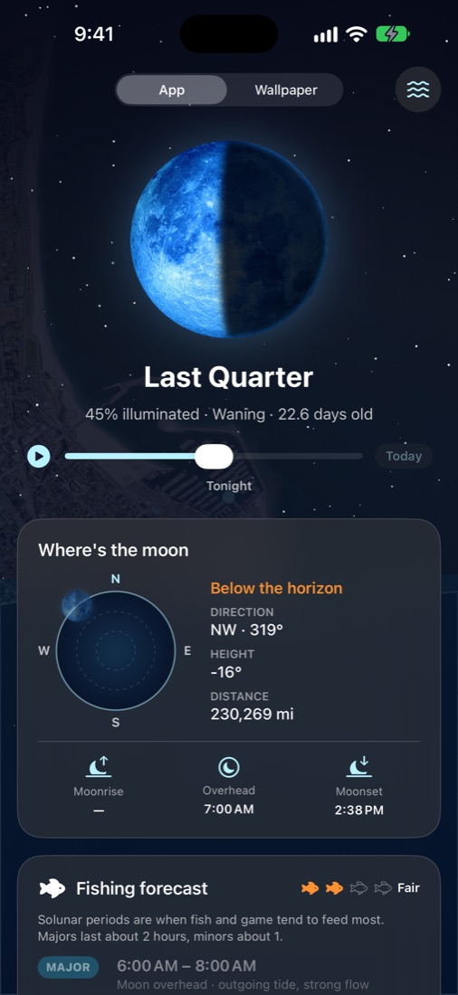
Lunatide moon side showing tonight's last-quarter moon over a starry sky
Living backgrounds

Your coastline, live, in every kind of weather.

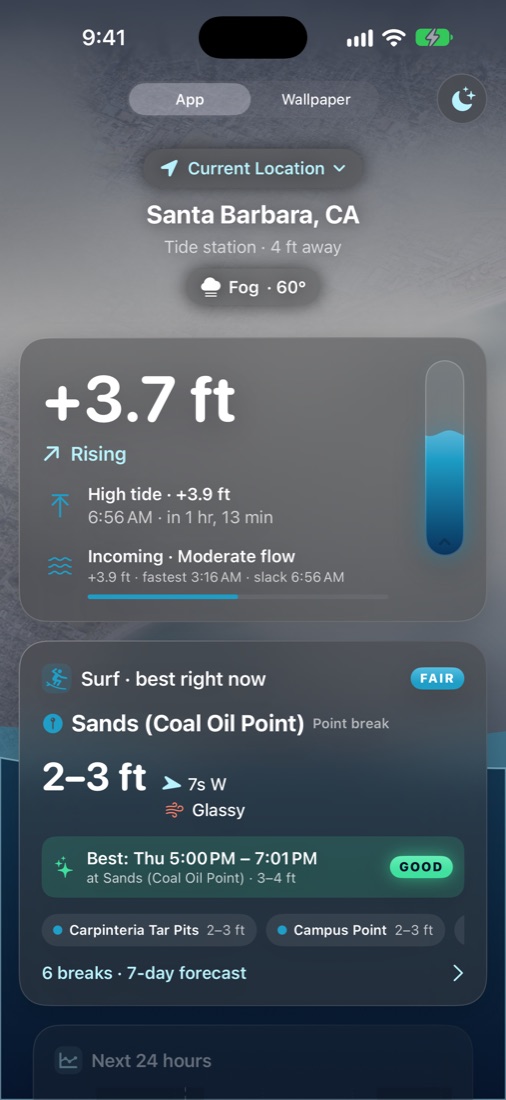
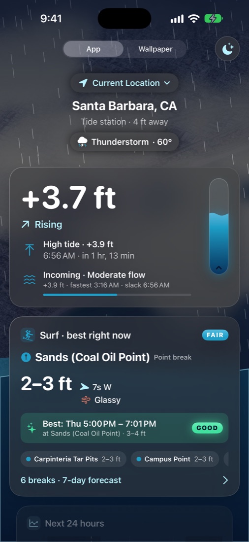
Lunatide flies in over a 3D satellite view of your actual coast, then slowly circles it. The sky follows the real sun, going deep blue at night and gold at sunset, and the live National Weather Service conditions play out on top: drifting fog banks, passing clouds, rain, lightning and snow. The water at the bottom rises and falls with the tide itself.

  • Real weather: fog, clouds, rain, storms, haze and snow
  • Day, golden hour, twilight and night lighting from the sun's true position
  • Waves that sit higher or lower with the live tide level
  • Gentle and battery-friendly, and still when Reduce Motion is on
Lunatide main screen with fog drifting over the Santa Barbara coastline
Lunatide main screen with rain and a dark stormy sky over the coastline
Tides

Know the water before you get there.

The current height, whether it's rising or falling, and a live countdown to the next high or low, from official NOAA predictions for the station nearest you.

  • 24-hour tide chart with day and night shading
  • Plus and minus heights, change per tide, and minus-tide badges
  • Tide flow: incoming or outgoing, fastest flow and slack water
  • Two weeks saved on your phone, so it works with no signal
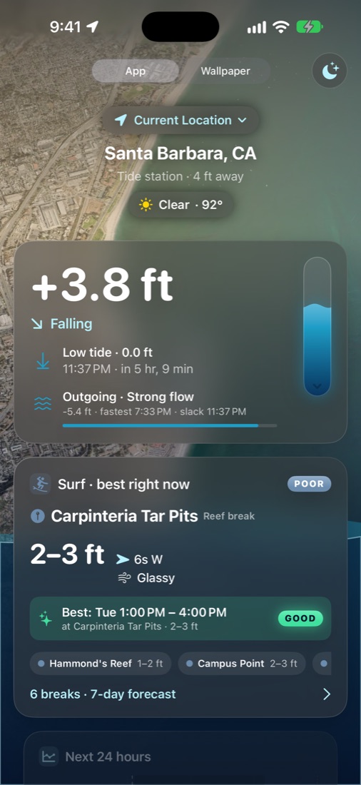
Tide screen with current height, next low tide and tide flow
Surf

Know which break is firing before you paddle out.

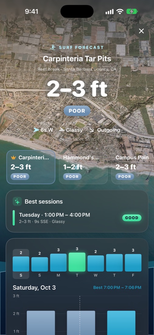
Lunatide forecasts the named surf breaks near you, from Rincon to Ditch Plains to the Abacos, and ranks them so the best spot right now is always on top. Each break is rated from Flat to Epic using the direction it actually faces, so offshore and onshore wind are judged the way surfers judge them.

  • Up to six nearby breaks, ranked live, with a crown on today's best
  • Tap any break to see its coastline, sessions and 7-day forecast
  • Wave height, swell period and direction, and wind, hour by hour
  • "Surf's up" alerts that name the break, about 90 minutes before it's good
Surf forecast for Carpinteria Tar Pits with a picker of nearby breaks, best sessions and a 7-day outlook
Boating

Check the water before you leave the dock.

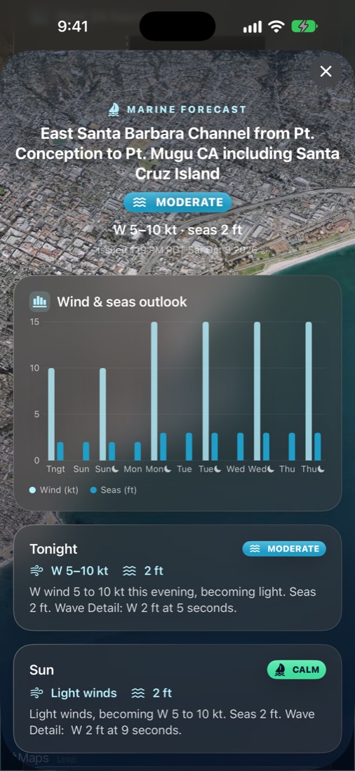
The official National Weather Service marine forecast for your stretch of coast, turned into something you can read at a glance: a clear Calm, Moderate, Choppy or Rough rating, wind and seas for every period, and any active advisories front and center.

  • Wind, gusts and seas for the next five days
  • Small Craft Advisories and marine warnings highlighted
  • Wind and seas chart, plus the full forecast in plain English
Marine forecast for the East Santa Barbara Channel showing moderate conditions, a wind and seas chart and period-by-period forecasts
Moon

Flip it over. Watch the moon move the sea.

One tap flips the app to a night sky with tonight's moon, lit for its exact phase and animated through the lunar cycle. See where it sits in your sky and how it drives the tide.

  • Moonrise, moonset and when it's overhead
  • Spring and neap tides explained, with king-tide alerts
  • Scrub ahead or back to see the phase on any date
Moon side showing the last-quarter moon and its position in the sky
Fishing

Fish when they're feeding.

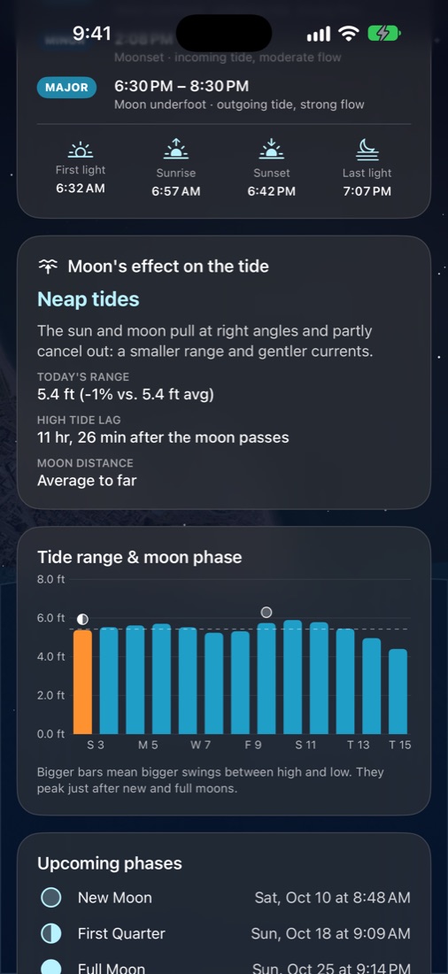
Solunar major and minor periods with a daily rating, matched with what the tide is doing at each one. Add first and last light, and live water temperature, wind and barometric pressure from the nearest NOAA sensors.

  • Daily fishing rating, from slow to excellent
  • Pressure trend, with what it usually means for the bite
  • 14-day chart of tidal range against the moon's phases
Solunar fishing times, sun times and the moon's effect on the tide
Everywhere you look

Your coastline, on every screen.

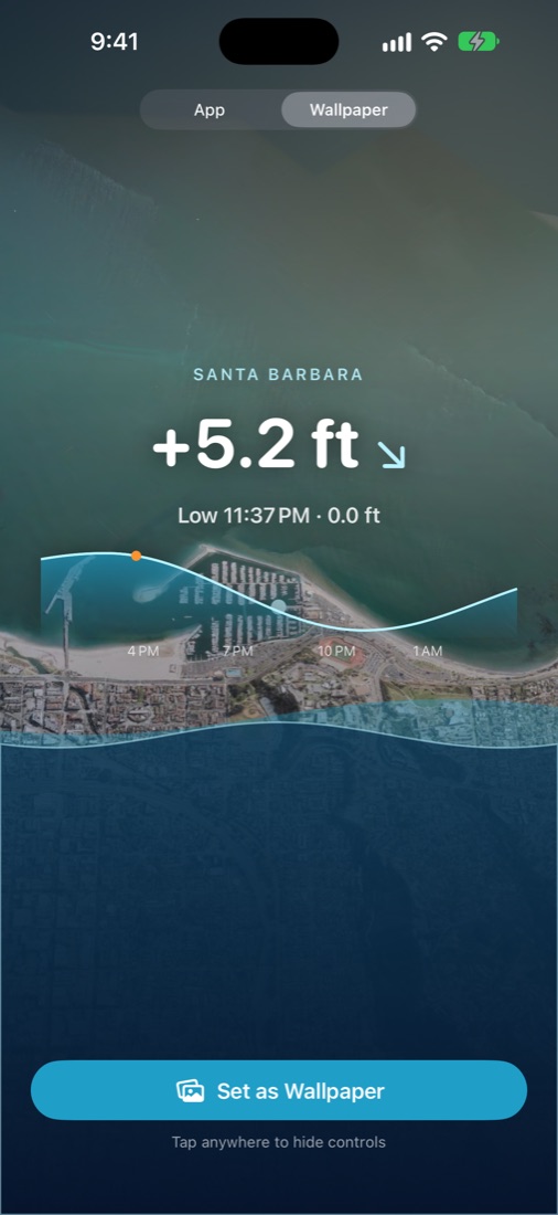
Home Screen and Lock Screen widgets, a Live Activity for the Dynamic Island and StandBy, and a wallpaper mode that turns your phone into a window on the water.

  • Widgets with the tide curve, moon phase and fishing rating
  • Live tide countdown on the Lock Screen
  • Shortcuts action to keep a tide wallpaper current
Wallpaper mode showing the tide over the satellite coastline
Surf alerts

A heads-up before it gets good.

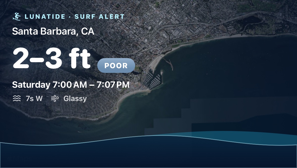
Turn on surf alerts and Lunatide watches every nearby break for you. About 90 minutes before a Good or Epic session, you get a notification with a card of the break, the wave height, the swell and the wind. Open the app while a session is coming up and a "Surf's up" banner slides in.

Surf alert card for Santa Barbara showing 2 to 3 feet, the session time, swell period and glassy wind over a satellite image of the coast
On your Mac

A screen saver that's actually worth watching.

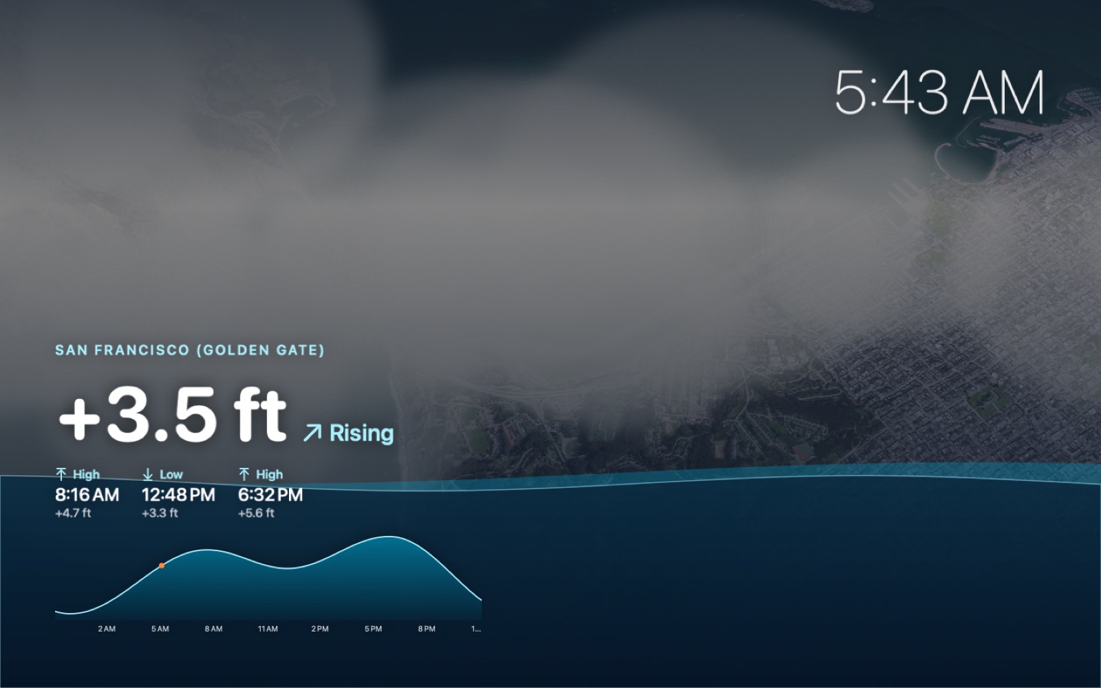
The Lunatide screen saver brings the living coastline to your Mac: the circling satellite flyover, live weather, animated tide water, a clock, the current height and the next highs and lows. Pick any beach in its options.

Lunatide Mac screen saver showing fog over San Francisco at dawn with the tide rising to 3.5 feet and the next highs and lows

Everything in Lunatide

The complete list.

🌊 Tides

  • Current height with a live water gauge
  • Rising or falling, plus countdown to the next turn
  • Interactive 24-hour chart: drag to read any time
  • Highs and lows with change per tide and minus-tide badges
  • Tide flow, fastest flow and slack water
  • Two weeks saved for offline use

🏄 Surf

  • 140+ named breaks, up to six nearby, ranked live
  • Flat-to-Epic ratings tuned to each break's facing
  • Hourly waves, swell and wind; drag the chart for details
  • Best sessions for each day
  • Surf alerts and the "Surf's up" banner

⛵️ Boating

  • Official NWS coastal waters forecast
  • Calm, Moderate, Choppy or Rough at a glance
  • Wind, gusts and seas for five days
  • Small Craft Advisories and marine warnings

🌕 Moon

  • Flip the app to the night side
  • Phase animated through the lunar cycle; scrub any date
  • Sky position, moonrise, moonset and overhead time
  • Spring and neap tides, king-tide alerts, 14-day range chart

🎣 Fishing

  • Solunar major and minor periods with a daily rating
  • First light, sunrise, sunset and last light
  • Water and air temperature, wind and pressure trend

⛅️ Living backgrounds

  • 3D satellite flyover of your coastline
  • Live weather: fog, clouds, rain, storms, snow
  • Sky lighting that follows the sun

📱 Everywhere

  • Home Screen widgets in three sizes
  • Lock Screen widgets and a Live Activity
  • Dynamic Island and StandBy
  • Wallpaper mode and a tide wallpaper Shortcut
  • Mac screen saver

✨ Thoughtful details

  • Search any beach, harbor or address
  • Siri and Shortcuts actions
  • Subtle haptics, and Reduce Motion support
  • No accounts, ads or tracking

Made with care, and real data

No accounts, no ads, no tracking. Just good information from sources you can trust.

Official tide predictions

Straight from NOAA Tides & Currents, for thousands of U.S. stations.

Official marine forecasts

Wind, seas and advisories straight from National Weather Service coastal waters zones.

Live weather on the map

Fog, clouds, rain and storms from the National Weather Service, drawn over your coastline.

Astronomy on your phone

Moon and sun positions calculated on the device, accurate to within minutes.

Private by design

Your location never leaves your iPhone. Lunatide collects no personal data.

Support

Answers to common questions. Still stuck? Email me and I'll help.

Where does Lunatide work?

Tide predictions come from NOAA, which covers U.S. coasts and territories, and weather comes from the National Weather Service. Surf forecasts work on most coastlines.

Why is my tide station a few miles away?

Lunatide uses the closest NOAA prediction station. Tap the location name at the top of the app to search for a specific beach, harbor or address.

How do I turn on surf alerts?

Open the Surf forecast and turn on Surf alerts at the bottom. Choose "Good or better" or "Epic only," and you'll get a notification about 90 minutes before a session that meets your bar.

How do I add the widget?

Press and hold an empty spot on your Home Screen, tap Edit → Add Widget, and search for Lunatide. The large widget shows the tide curve, moon phase, fishing rating and the next highs and lows.

Which surf breaks are included?

Over 140 named breaks across California, Oregon, Washington, Hawaii, the East and Gulf coasts, Puerto Rico and the Abacos. Lunatide shows up to six within about 37 miles of you, ranked by how good they are right now.

Where does the boating forecast come from?

It's the National Weather Service Coastal Waters Forecast for the marine zone you're in, with active advisories. Calm, Moderate, Choppy and Rough are Lunatide's at-a-glance summary of the forecast wind and seas; always read the full forecast and use your judgment before heading out.

How is the surf rating worked out?

It combines wave size, swell period, whether the swell can reach your beach, wind direction relative to the shore, and the tide. Lunatide works out which way each beach faces automatically.

Can I use it for navigation?

No. Lunatide is for planning and enjoyment. Tides are predictions, and real water levels vary with wind, pressure and runoff. Always use official charts and current conditions on the water.

Need a hand?

Email the place you were checking and a screenshot if you can. You'll usually hear back within a couple of days.

bailey@baileyhcaldwell.com